Define and implement a geospatial strategy
A geospatial strategy is a business-oriented plan for how your organization will leverage its geospatial resources (people, processes, and technology) to produce the outcomes it’s trying to create. Organizations that develop and implement a geospatial strategy successfully connect and align GIS technology to their business, deliver quick value based on priorities, and define and implement sustainable solutions that solve business challenges.
A business-first approach to maximize the impact of GIS
Many successful organizations maximize the impact of GIS in their business by developing and implementing a geospatial strategy. A geospatial strategy gives organizations a way to align their geospatial capabilities and technologies to their underlying business needs. By implementing this business-first strategy, organizations can use GIS to reach their goals and improve outcomes throughout the business.
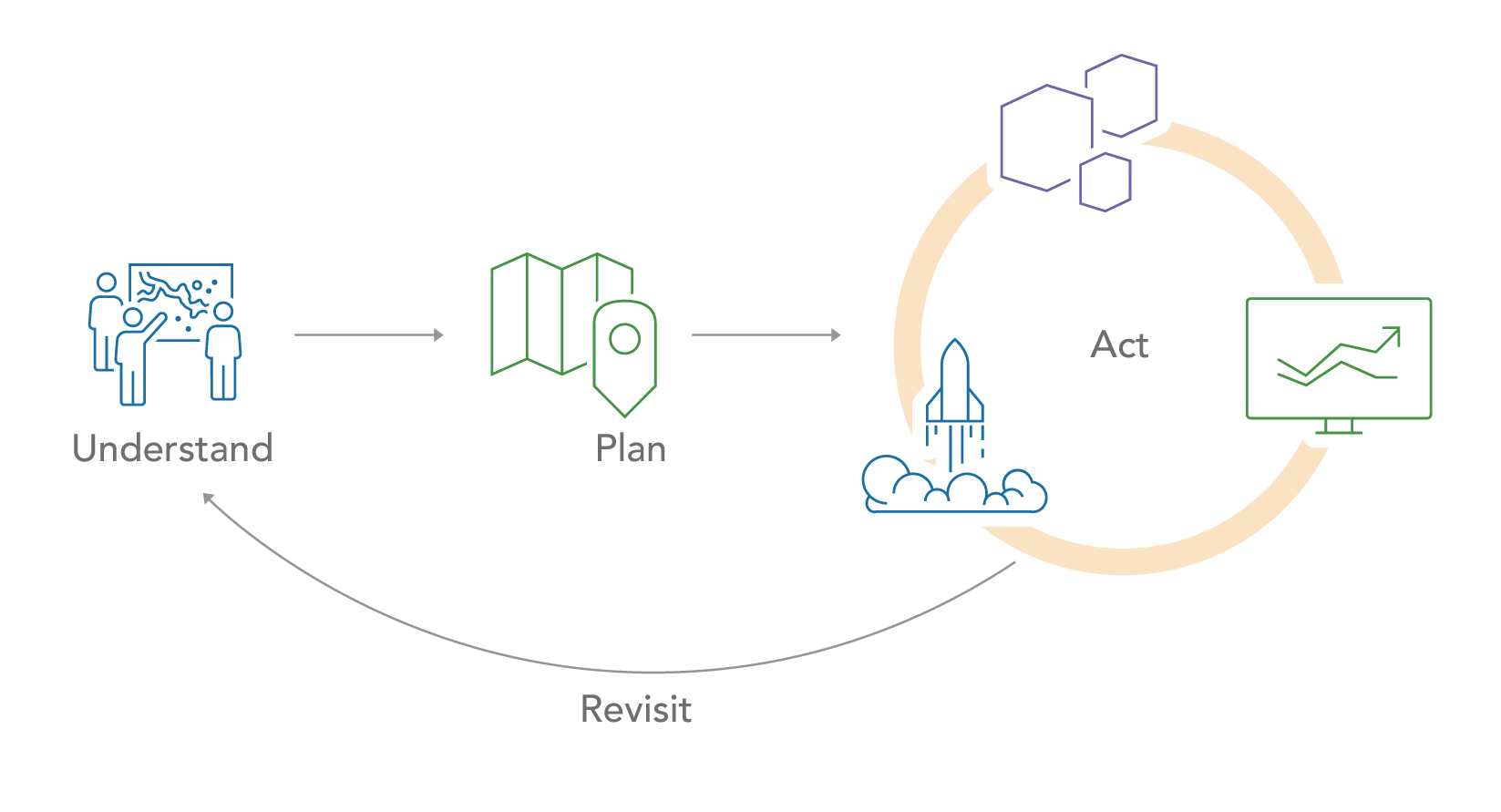
Employing a geospatial strategy requires a passionate team of leaders that want to solve business challenges within their organization and improve the way their organization works. Successful teams include a champion that believes in the value of geospatial solutions, an executive sponsor that provides resources and funding, and a technical sponsor that provides resources to implement and maintain sustainable solutions. With this team, you can develop and implement a geospatial strategy, following a four-phase approach.

Understand
In the Understand phase, the team engages with stakeholders across the organization including departmental and functional area executives, key business unit directors, and GIS users and managers. Through these meetings, the team learns what is driving these stakeholders and develops a shared understanding of the organization, its goals, and its challenges. The outcome of this phase is clear and shared knowledge of the organization including its mission, goals, business challenges, and more.
Plan
In the Plan phase, the team defines the targeted future state that will allow the organization to overcome its challenges and meet its goals, and then identifies the gaps between existing capabilities and what is needed. By comparing the current and future states, the team can define the technology, data, workflows, and skills necessary to establish sustainable solutions that address business needs. This phase concludes with a road map, which is a prioritized and sequenced set of activities.
Act
In the Act phase, the team applies a series of implementation cycles (prepare, implement, operate, review) consisting of activities defined in the road map. This means not only deploying new technical capabilities, but also ensuring staff are ready to use it and understand the value it brings to the organization. Each implementation cycle should result in one or more tangible outcomes.
Revisit
In the Revisit phase, the team adapts and updates the plan as leadership goals change, business priorities shift, and technology evolves. The plan should be revisited regularly—especially after each implementation cycle—to ensure it is maximizing the impact of GIS on the organization.
This approach supports an incremental implementation guided by a geospatial strategy. It allows the team to develop and implement a plan that aligns geospatial technology to the needs of the business and delivers continuous value.
Recommendations
To define and implement your own geospatial strategy:
- Review Esri’s approach to developing a geospatial strategy, and then form a team that includes a motivated champion, an executive sponsor, and a technical sponsor.
- Develop and implement your geospatial strategy by engaging stakeholders across your organization, identifying business challenges, developing a plan that addresses the needs of the business, implementing solutions through an incremental process, and revisiting your plan over time.
- Leverage best practices to maximize the impact of your geospatial strategy and GIS within your organization.