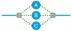
Option 3: Industry standard data model
This option builds on the capabilities of Option 2: User provided topological network data model.
Organizations using this option can leverage capabilities to accurately model real-world assets, facilitating the creation of a digital twin of your network information. Esri and its partners provide industry-standard models, accompanied by connectivity rules, that ensure network data integrity and promote a consistent representation across all integrated systems.
This option leverages the breadth of ArcGIS Utility Network technology to:
- Maintain your organization’s data with the details necessary to support critical analysis capabilities, both within the GIS and other mission critical applications
- Manage subnetworks, including phase, pressure, isolation, cathodic protection
- Manage mixed status of devices in groups, such as banks, assemblies, and stations
- Precisely model device operations with industry specific connectivity rules
- Adhere to well-defined industry standard models
- Accommodate the highly-extensible modeling of asset information with required completeness
- Enable industry standard data integrity checks
- Integrate with external systems via standards-based methods
- Offer multiple options for maintaining network details, based on organizational requirements
This option enables the management of network information through various viewpoints, leveraging modeling approaches for components or network assets. Spatial component models and non-spatial component models are available as advanced capabilities in this option and can be utilized to accommodate a range of requirements.
Components as non-spatial objects
- One network feature for the bank, units modeled as nonspatial junctions contained in the bank and connected to the network
- This is a variation on non-spatial model which adds connectivity for the units to the network to support more fine-grained control over network flow by phase

Components as spatial objects
- Bank as an assembly feature with no network connectivity and units as feature devices with network connectivity
- Highly detailed spatial information model and spatial data governance
- Provides accurate spatial data management at individual device level
- Inside plant or inside device spatial information management
