Introduction to ArcGIS
ArcGIS is a comprehensive geospatial platform for professionals and organizations, and the leading geographic information system (GIS) technology. GIS is a proven IT technology that helps users understand patterns, relationships, and geographic context, providing a foundation for mapping and analysis that is used for business, operational, and scientific workflows in almost every industry.
ArcGIS connects maps, apps, data, and people in ways that help empower organizations to make data-driven decisions more efficiently. ArcGIS accomplishes this by making it easy for everyone in an organization to discover, use, make, and share maps from any device, anywhere, at any time. ArcGIS is designed to be flexible, offering these capabilities through multiple implementation patterns and approaches. Together, these capabilities and flexible approaches make it easier for you to extend the reach of GIS across your entire organization.
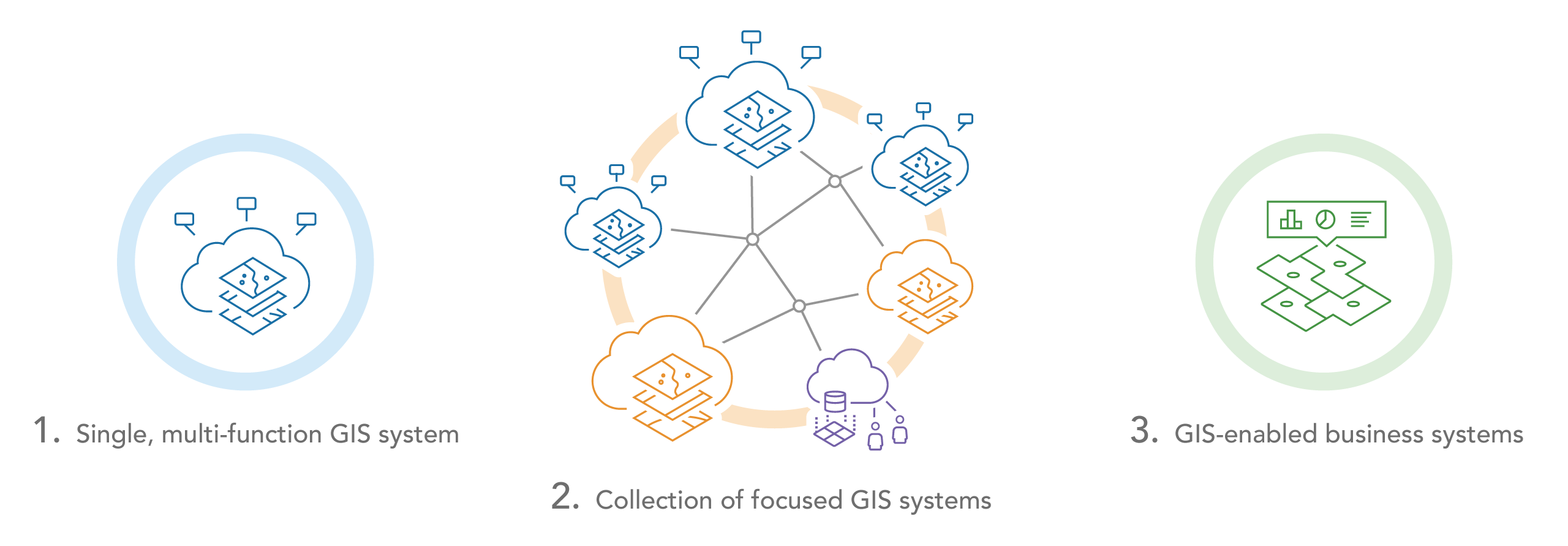
Organizations typically implement ArcGIS within their enterprise system portfolio in one of three ways:

- As a single, multi-function GIS that supports a variety of user needs and workflows and delivers a wide range of capabilities.
- As a collection of GIS systems, each of which delivers a focused set of capabilities to the enterprise. This may include systems of record for managing different types of data, systems of insights for empowering data scientists and other users with a variety of analytic capabilities, and systems of engagement for delivering location services, enterprise applications, and self-service capabilities.
- Using ArcGIS to extend and enable existing business systems, such as Enterprise Asset Management (EAM) or Customer Relationship Management (CRM) systems, with location, mapping, and spatial analysis capabilities.
Geographic information systems (GIS), as compared to other information technology systems, typically plays a unique role in an organization by integrating data and workflows from across the enterprise. This integration of data and workflows is made possible through the use of location. The majority of data has an inherent location component and can therefore be used as a key to link and understand otherwise unrelated datasets. GIS has its own information models that allow the flexibility in connecting to and spatially enabling existing enterprise data and informational assets.
Continue to learn about:
- ArcGIS as enterprise-grade technology
- The comprehensive geospatial capabilities of ArcGIS
- ArcGIS as a geospatial AI platform
- The architecture of ArcGIS
Related resources: